


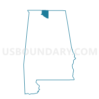
Belmore Baptist Church, Limestone County, Alabama
About
Outline

Summary
| Unique Area Identifier | 522291 |
| Name | Belmore Baptist Church |
| County | Limestone County |
| State | Alabama |
| Area (square miles) | 61.93 |
| Land Area (square miles) | 48.77 |
| Water Area (square miles) | 13.16 |
| % of Land Area | 78.74 |
| % of Water Area | 21.26 |
| Latitude of the Internal Point | 34.62237050 |
| Longtitude of the Internal Point | -86.86206120 |
Maps


Graphs
Select a template below for downloading or customizing gragh for Belmore Baptist Church, Limestone County, Alabama


Neighbors
Neighoring Voting District (by Name) Neighboring Voting District on the Map
- Athens Recreation Center, Limestone County, AL
- Center Springs Methodist Church, Morgan County, AL
- Eastwood Elem School, Morgan County, AL
- Isom's UMC-Creekside Elem, Limestone County, AL
- J.E. Williams Elem School, Madison County, AL
- Lamb of God Lutheran Church, Limestone County, AL
- Madison Bapt Church, Madison County, AL
- Morgan Co Courthouse, Morgan County, AL
- Priceville Fire Station, Morgan County, AL
- Somerville Rd Elem School, Morgan County, AL
- Tanner Fire Dept, Limestone County, AL
- Triana City Hall, Madison County, AL
- Turner Surles Community Resource Center, Morgan County, AL
Top 10 Neighboring County Subdivision (by Population) Neighboring County Subdivision on the Map
- Athens CCD, Limestone County, AL (69,761)
- Decatur CCD, Morgan County, AL (61,269)
- Madison CCD, Madison County, AL (39,245)
- Somerville CCD, Morgan County, AL (10,369)
- Mooresville CCD, Limestone County, AL (9,438)
- Triana CCD, Madison County, AL (8,316)
Top 10 Neighboring Place (by Population) Neighboring Place on the Map
- Huntsville city, AL (180,105)
- Decatur city, AL (55,683)
- Madison city, AL (42,938)
- Mooresville town, AL (53)
Top 10 Neighboring Unified School District (by Population) Neighboring Unified School District on the Map
- Huntsville City School District, AL (172,297)
- Madison County School District, AL (123,029)
- Limestone County School District, AL (57,348)
- Decatur City School District, AL (55,683)
- Morgan County School District, AL (50,012)
- Madison City School District, AL (42,938)
Top 10 Neighboring State Legislative District Lower Chamber (by Population) Neighboring State Legislative District Lower Chamber on the Map
- State House District 25, AL (64,950)
- State House District 4, AL (51,181)
- State House District 10, AL (50,267)
- State House District 5, AL (48,495)
- State House District 9, AL (45,371)
- State House District 8, AL (42,351)
Top 10 Neighboring State Legislative District Upper Chamber (by Population) Neighboring State Legislative District Upper Chamber on the Map
Top 10 Neighboring 111th Congressional District (by Population) Neighboring 111th Congressional District on the Map
Top 10 Neighboring Census Tract (by Population) Neighboring Census Tract on the Map
- Census Tract 212, Limestone County, AL (9,438)
- Census Tract 112, Madison County, AL (8,316)
- Census Tract 211, Limestone County, AL (6,578)
- Census Tract 54.05, Morgan County, AL (5,208)
- Census Tract 54.04, Morgan County, AL (5,161)
- Census Tract 1, Morgan County, AL (4,435)
- Census Tract 4, Morgan County, AL (3,929)
- Census Tract 110.21, Madison County, AL (3,912)
- Census Tract 2, Morgan County, AL (3,623)
Top 10 Neighboring 5-Digit ZIP Code Tabulation Area (by Population) Neighboring 5-Digit ZIP Code Tabulation Area on the Map
- 35758, AL (41,875)
- 35601, AL (34,434)
- 35603, AL (30,545)
- 35613, AL (20,546)
- 35756, AL (9,016)
- 35670, AL (7,676)
- 35824, AL (6,070)
- 35671, AL (2,107)
- 35615, AL (68)
- 35649, AL (68)